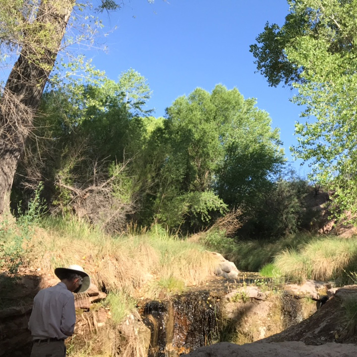
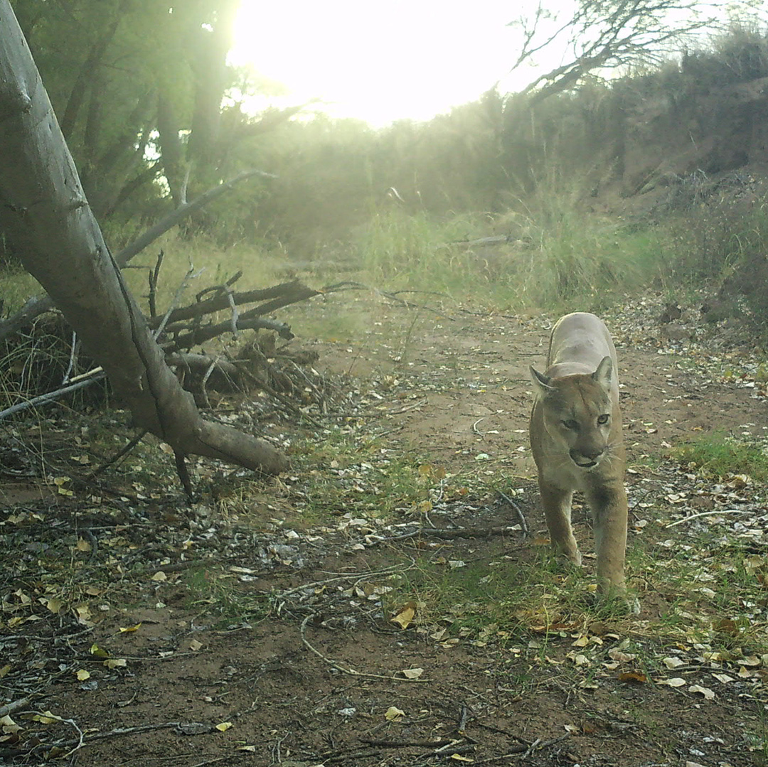
SIA cofounder Dale Turner surveys a spring along the San Pedro in 2025.San Pedro spring by Dale Turner and Julia Fonseca.Mountain lion on San Pedro River (SIA)
This June, in partnership with The Nature Conservancy, Sky Island Alliance is supporting a Spring Seeker campaign along the San Pedro River, and we’re in need of self-motivated volunteers to head out in the field independently and help make it a success. This marks the second year of spring surveys in the area in conjunction with wet/dry mapping, and it’s the 27th year of wet/dry mapping overall!
See signup details below. While June is one of the hottest times of year, it’s also the best time to check on springs to see if they’re perennial water sources. By surveying springs during dry periods, we can learn about their health, flow rates, and how they support biodiversity during drought conditions.
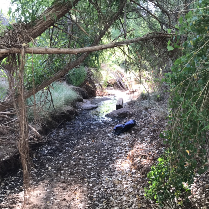
Winding through the Sonoran and Chihuahuan deserts, the San Pedro River plays a crucial role in the survival and migration of wildlife across the Southwest. Originating in Sonora, Mexico, the river winds its way into southeastern Arizona, creating one of the last large, undammed riparian ecosystems in the region. Millions of birds use it as a crucial stopover habitat during migration each year. And while the surrounding deserts can be dry, the ribbon of cottonwood trees remains a vibrant green. In total, more than 250 species of birds, 14 species of fish, 84 species of mammals, and 41 species of reptiles and amphibians call the San Pedro Valley their home.
Learn more below about how to get involved in this volunteer effort to survey the river’s vital springs. And if you can’t get to the San Pedro, we have other springs also in need of surveying across the region.
Complete Signup Sheet: Visit our signup sheet and fill out your information for the springs you would like to survey. Make sure you choose a route that best suits your capabilities, and feel free to reach out if you have questions.
Download Survey123: Visit the app store (Apple | Android) to download the free Survey123 app on your smartphone or tablet. Note: Once downloaded, using this app does not require Wi-Fi or cell service.
Download the Spring Seeker survey: Click here to download and open the survey for our project on your smartphone or tablet before you go to the field. Once you’ve opened the link, choose “open in Survey123.” Continue without signing in, when prompted.
Prepare for your trip: Open our Spring Seeker Safety Guide to learn about land access and other tips while in the field. Please keep in mind that June can be a very hot time of year, so plan accordingly. Be sure to bring sun protection (hats, sunscreen, etc.), plenty of water, comfortable hiking shoes, and snacks. Don’t hesitate to turn around if you need to, even if it means not getting to all the sites.
After checking our trip planning guide for tips on parking and navigation and checking the Survey123 app for any updates to the Spring Seeker survey, head to the spring you’ve signed up to survey. Once there, fill out the Spring Seeker survey and let us know what you’re seeing (water, native plants, invasive species, signs of fire or mining, wildlife tracks, etc.). You can submit the survey onsite if you have cell service or save and submit when you return home.
Note – Cienega sites can be complex to survey due to multiple spring emergence points and a large area affected. If it seems feasible to do so safely and without damaging resources, it is recommended to walk around the entire area of plants that indicate additional water, taking some photos along the way. Then sit down somewhere comfy to complete your survey so you have a complete picture of the site.
Once back from the field, don’t forget to enter your mileage and volunteer time. We use this information for matching grants from some sources that require us to provide a certain amount of work or funding to be able to access the grant.
If you have questions, feel free to reach out to our Habitat Restoration Manager Sarah Truebe. And keep an eye on our events calendar for upcoming volunteer trips and workshops.
How These Spring Surveys Fit In
Data from these surveys will help the Arizona Department of Environmental Quality establish flow regimes for stream segments throughout the watershed, a significant statewide data gap. If you’d like to volunteer in other wet/dry mapping efforts, see ADEQ’s website for details.
The Nature Conservancy is also working on a LiDAR-based model of wet/dry conditions, which these surveys will be used to help verify.