Junior Spring Seeker Activity Book-2026
In 2022, SIA Habitat Restoration Manager Sarah Truebe worked with a group of UArizona students to develop a resource to introduce kids to Sky Island springs and show them why these precious water sources are so important. The result was a fun project reminiscent of Highlights magazine — with crosswords, mazes, word scrambles, and other games.
We now have an online version of our Junior Spring Seeker Booklet that’s free to download and print. It’s a great resource for teachers, parents, or anyone looking for a meaningful activity to engage kids. If you have a special event coming up and would like hard copies for your group, send us an email and we’ll be in touch.
Visit Link
Guía práctica para restauracíon y uso sustentable de manantiales en Sonora, México
Esta guía describe la importancia de los manantiales para las personas y la vida silvestre, las amenazas actuales a estos recursos naturales y las actividades de restauración en las que estamos trabajando con los ganaderos de Sonora.
Springs guide also available in English.
Visit Link
Sky Island Waters: Adapting the Way Spring Ecosystems are Monitored, Managed, and Restored
This final report of work accomplished was put together in March 2021 for the BOR WaterSMART Applied Science Grant. The report details the tasks completed for three main projects: the creation of our Spring Prioritization Tool, the guidance we developed for spring monitoring based on currently used spring-monitoring approaches, and the work we did with managers and local stakeholders to use and revise the Arizona Springs Restoration Handbook.
Visit Link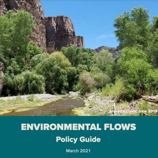
Environmental Flows Policy Guide
Sky Island Alliance and UArizona’s Water Resources Research Center have worked together since 2016 to promote dialogue, understanding, and innovation in our community with the goal of securing environmental flows for water-dependent natural areas. This guide outlines management options for ensuring environmental flows by exploring the status of policies and regulations, highlighting successful example projects, showcasing available tools for local decision-making, and identifying future pathways to include natural areas alongside human uses in water management.
Visit Link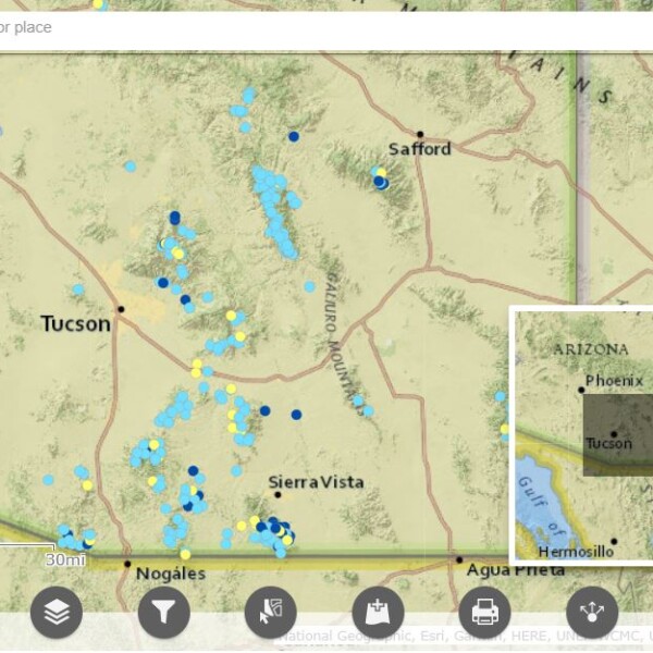
Sky Island Springs Prioritization Tool
Sky Island Alliance created this tool to help land managers gain insight into the state of nearly 4,000 springs in southern Arizona. It’s a database, conservation-science model, and dynamic map that allows users to compare the relative conservation value, level of threat, and spatial isolation of springs from other perennial water sources. With our map, users can compare the condition and risk of springs across public and private lands and use this info to guide conservation efforts. Version 1.0 includes only springs in the U.S. portion of the Sky Islands, but we plan to expand future versions to include springs in Mexico.
Visit Link
Localización, caracterización y perturbaciones antropogénicas de manantiales cercanos a la ruta Esqueda – Sierra del Tigre, Sonora
Este proyecto de tesis, escrito por nuestro becario Ángel García, investiga la distribución, condición y características biológicas de los manantiales de Sonora, además de las amenazas que enfrentan. Para completar la investigación, Ángel estudió una pequeña área de las Islas del Cielo en Sonora y utilizó Spring Seeker y los “Springs Ecosystem Inventory Protocols” del Springs Stewardship Institute para hacer una evaluación completa de los manantiales dentro de esta área.
Visit Link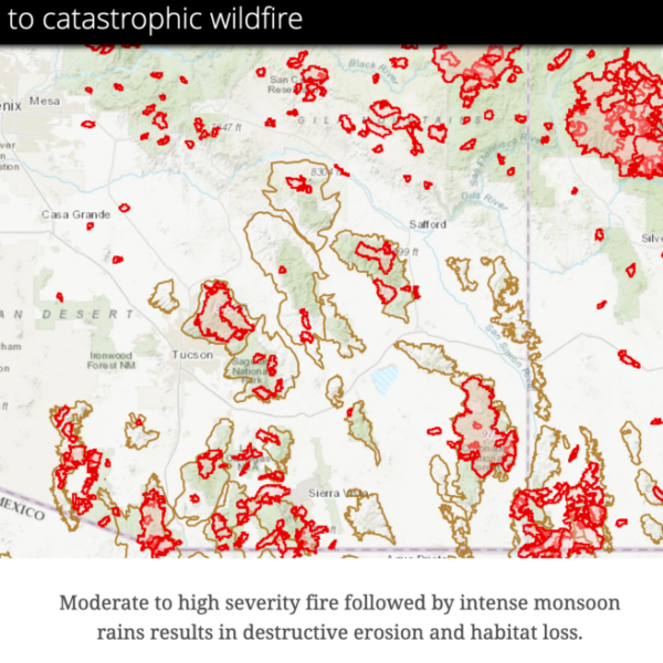
Story Map: Enhancing Resilience to Catastrophic Wildfire
In the past 15 years, 25% of the U.S. Sky Islands have burned in wildfires. Moderate- and high-burn severity made up 35% of the burned area. This story map shows where Sky Island Alliance worked with the Coronado National Forest, Arizona Department of Corrections, and Borderlands Restoration Network in 2015 to install more than 700 loose rock erosion-control structures in two watersheds to help enhance their resilience to catastrophic wildfire.
Visit Link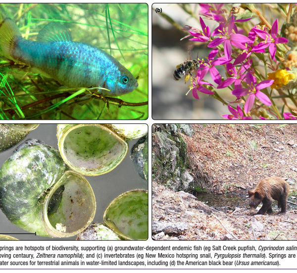
Oases of the future? Springs as potential refugia in drying climates
Within arid regions, natural springs are biodiversity hotspots that have a strong influence on surrounding landscapes despite their small size. During previous periods of climate drying, some springs served as refugia for certain species. Understanding whether springs will continue to provide refuge under future climate change is key to land management and conservation but complicated by several factors, including hydrologic variability among springs, data limitations, and other groundwater threats. In this report, we present a framework for categorizing springs as potentially stable, relative, or transient refugia using several approaches, including citizen-science monitoring, remote sensing, landowner interviews, and environmental tracer analysis.
Visit Link
Springs Assessment for Cienega Creek Basin
This report details the methodology and results of Sky Island Alliance’s two-year project to assess springs in the Cienega Creek Basin, and to make newly collected and previous information from agencies available through the Spring Stewardship Institute’s online database. See the full report, plus Appendix A, Appendix B, and Appendix C.
Visit Link
Arizona Springs Restoration Handbook
This handbook was co-produced with the Springs Stewardship Institute with support from the Desert Landscape Conservation Cooperative. It is meant to advance the understanding of springs by land managers in Arizona, as well as promote communication, stewardship, and collaboration, and to provide guidance to land managers embarking on springs-stewardship programs.
Visit Link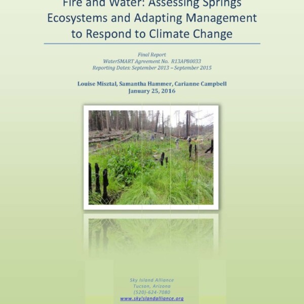
Fire and Water: Assessing Spring Ecosystems and Adapting Management to Respond to Climate Change
This report details the methodology and results of Sky Island Alliance’s two-year project to inventory and assess springs in the Upper Santa Cruz River Basin, assess impacts of fire on spring ecosystems, develop a volunteer-based Adopt-A-Spring program to monitor springs, develop an Arizona Springs Restoration Handbook and to develop guidance and strategies to reduce vulnerability of springs to climate change.
Visit Link