

The following is part of a series of recommended Sky Island hikes. Be safe, have fun, and leave no trace.
Ready for an adventure? I suggest the Reef Townsite Loop Trail and a weekend of camping at the nearby Reef Townsite Campground. This little gem is in the Carr Canyon area, accessed via the east side of the Huachuca Mountains in the Coronado National Forest. Carr Peak is the second-highest peak in the Huachucas and part of the 20,190 acres of Miller Peak Wilderness designated in 1984.
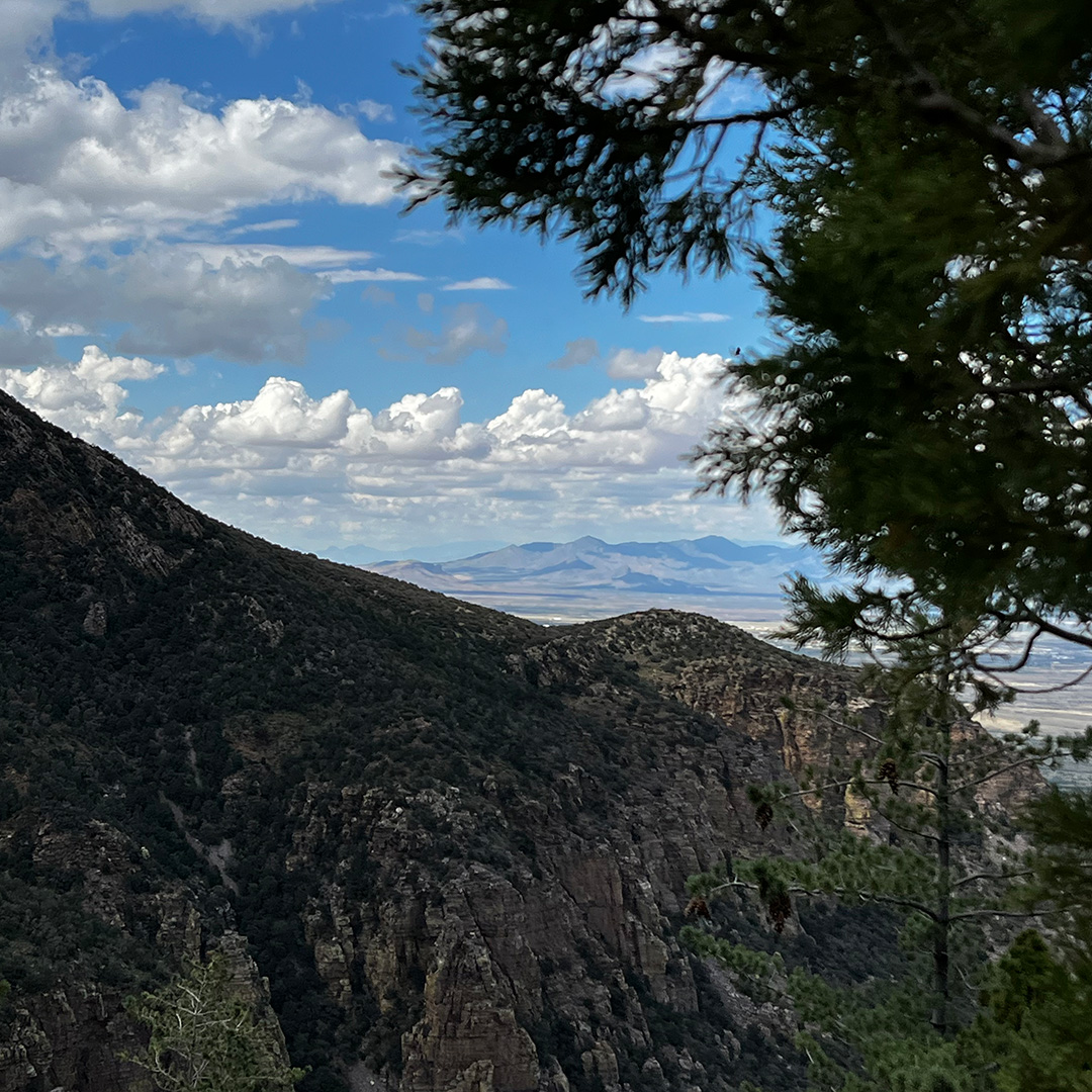
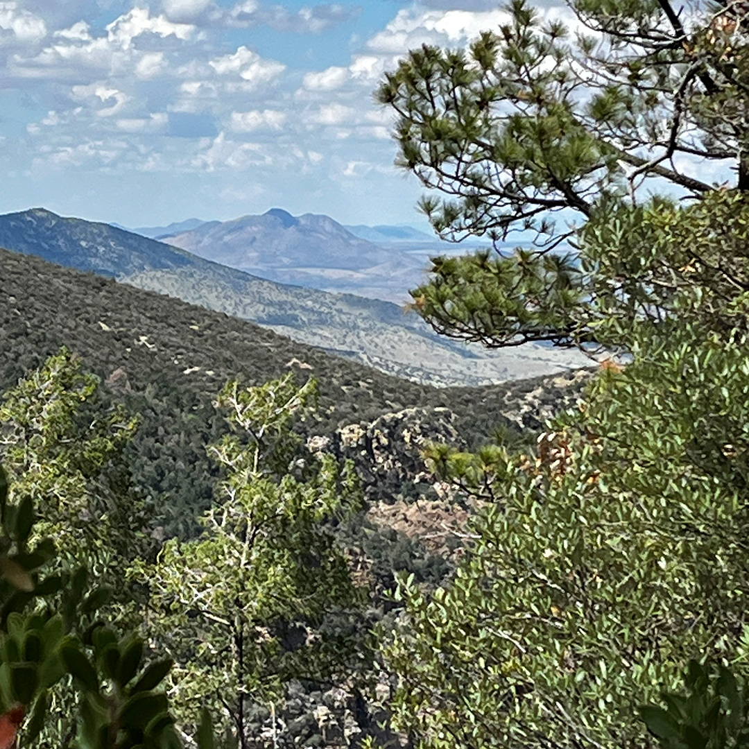
What’s a reef doing at 7,200 feet above sea level? This “reef,” or thick layer of exposed rock, is actually made up of quartzite-bearing cliffs that form the dramatic eastern face of the Huachuca Mountains. Carr Canyon and Carr Reef are both named after James Carr, who immigrated to America from Ireland with his mother at the age of six in 1858. He worked in lumbering, freighting, and road building in the Southwest and Mexico.
In April 1880, James Carr purchased a sawmill in Carr Canyon near the present-day trail. The lumber was used to build mining, milling, and boarding facilities in Tombstone. In 1884, Carr sold Carr Canyon sawmill, toll road, and a 160-acre land claim with a small frame house for $3,000 and moved to Kansas City with his wife and child. He later died on a train in Coconut, Sonora, while on a mining trip in 1926. He is buried there.
For the drive up to the trail via Carr Canyon Road, I’m going to direct you to a blog by Arizona Highways. But let’s just say, it’s not for the faint of heart. Our Communications Coordinator Rick Mick has done it a few times in his Honda Fit, and while it’s possible and even easygoing in stretches, there are some switchbacks and rocky, washed-out sections where a 4-wheel drive helps. Take note.
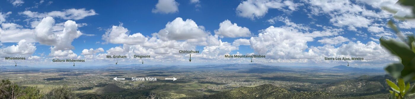
On the drive up, you’ll pass by Carr House, owned and operated by Friends of the Huachuca Mountains. My husband and I chose not to stop there this time, as the day was glorious, and we wanted as much time as possible to take in the views. If views are what you’re after, there are many pullouts along the way.
Around 6.5 miles up the road, you finally arrive at the Reef Townsite Campground, which has 16 campsites and one reservable group site. From Carr’s ownership up until the 1950s, this area was a small mining town, with its own post office at one time. Then it returned to public ownership in 1970 and finally became a campsite around 1980.
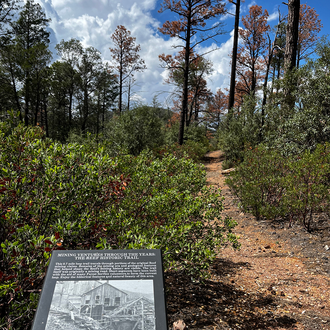
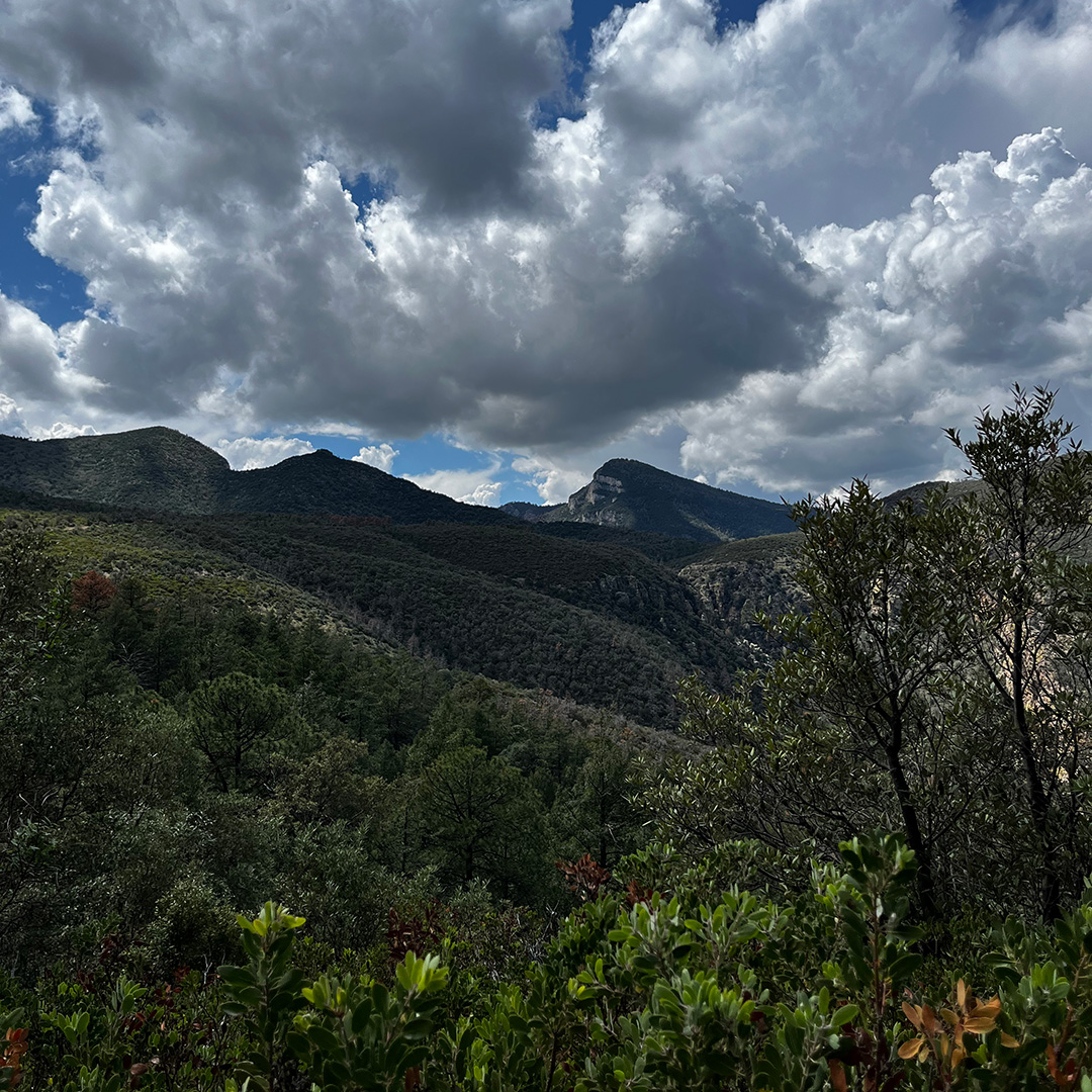
From inside the campground is where you access the Reef Townsite Loop Trail, one of many hiking opportunities in the area. This enjoyable 1.5 mile loop trail is easy and has interpretive signs along the way illuminating the area’s mining history. But the best part is the views.
Getting There
If you don’t stop every five seconds to take in views, the drive is about 2.5 hours from Tucson. But you’ll want to stop. You can absolutely do this as a day trip. But while we were there, we immediately were sad we didn’t plan it as a camping weekend — maybe next time. So take that into consideration.
From Tucson, Arizona: drive east on I-10 to exit 302. Go south on State Route 90 for 33 miles through Sierra Vista. Turn right/south onto State Route 92 for four miles. Then turn right/west onto Carr Canyon Road (Forest Road 368). About 6.5 miles up the road, you’ll see signs for Reef Townsite Campground. Pull in and drive to the furthest site. Parking is available at the covered picnic area. Trail access is between the picnic area and campsite. See map.
Love birds? This is a great area to see them. Here’s my husband John’s bird list from the day we visited.