The following is part of a series of recommended hikes in the Sky Islands — be safe, have fun, and leave no trace.
According to popular wisdom, the Sierra Huérfana in Sonora owes its name to a land dispute between the pueblos of Álamos, Rancho Viejo, and Mazatán. To avoid problems the range is simply called the Sierra Huérfana (Orphan Mountains) — but it’s also known as Bachán or Mazatán.
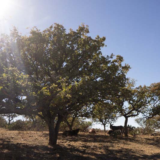
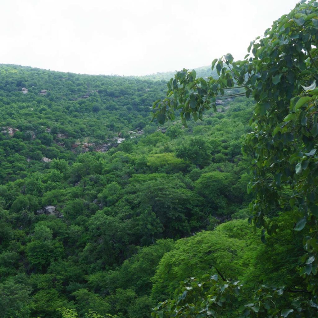
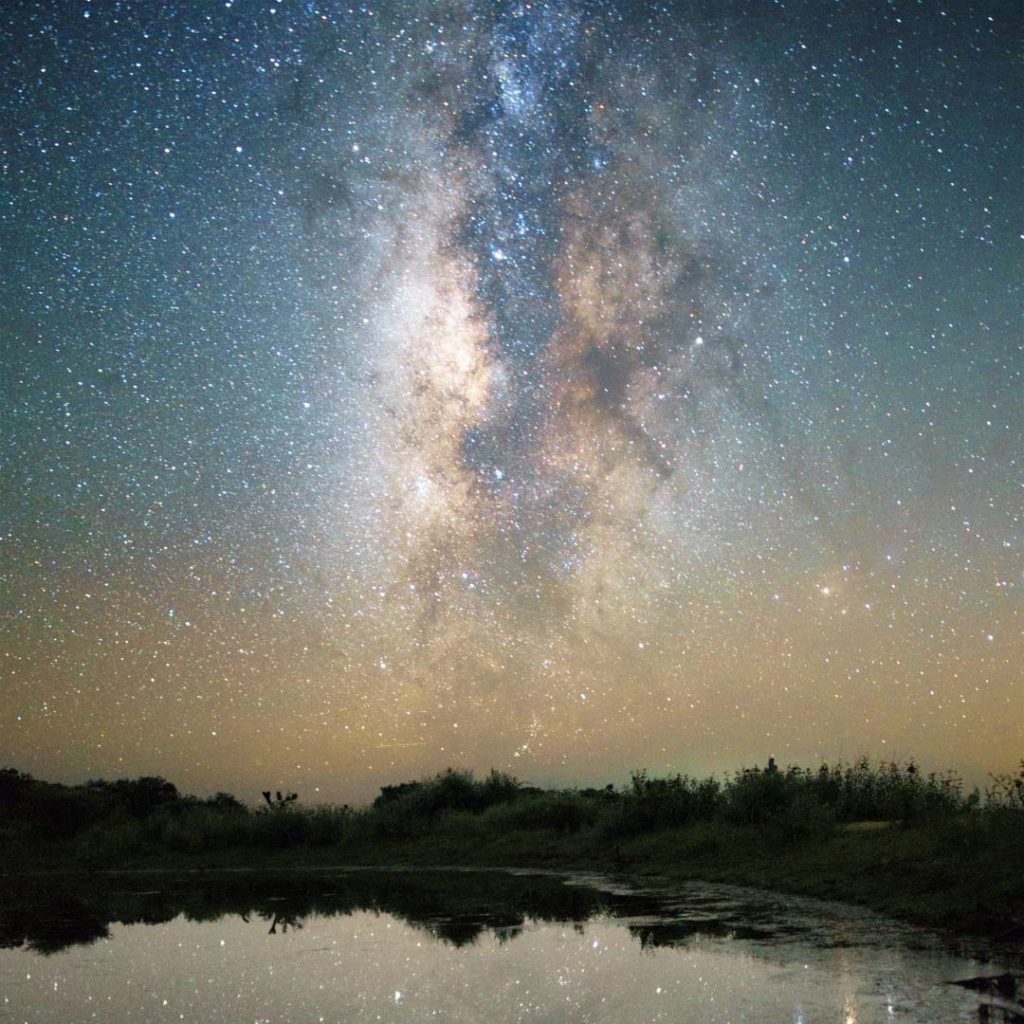
It’s the southernmost Sky Island and a true gem, where you can escape from the city to enjoy some cool, live with nature, and appreciate the stars. The hike begins in the Sonoran Desert, passes through low deciduous forest, and ends in oak forest. This is believed to be the westernmost range of jaguars.
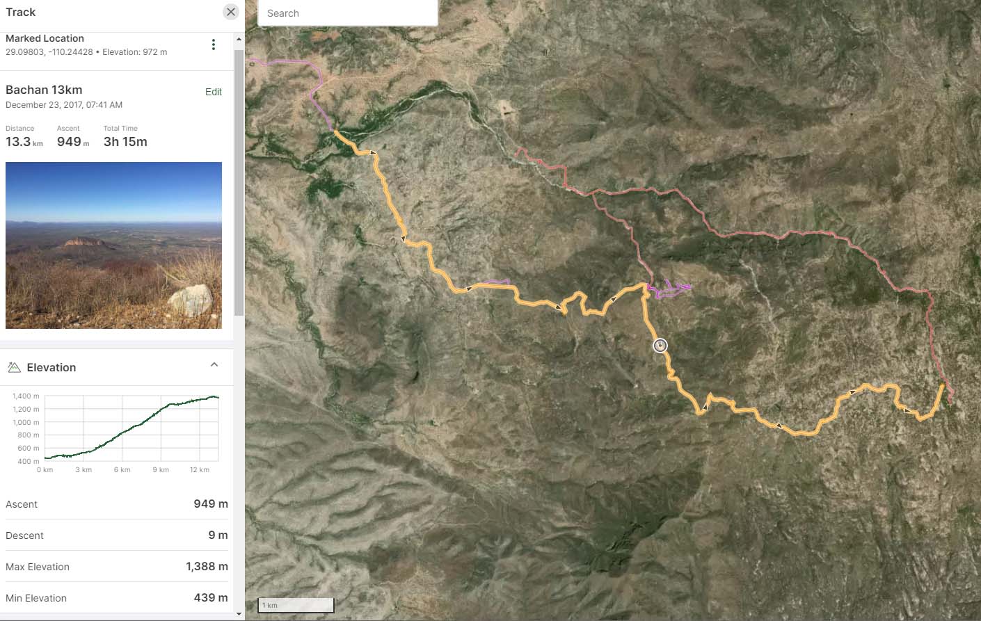
The full hike to the top is 26.6 kilometers round-trip but can be enjoyed at any distance if you want to turn around early. It involves roughly 950 meters of elevation gain and tops out just over 1,400 meters. From the top you can see the lights of Hermosillo in the distance. In the winter, snow dustings are possible. And in the summer there are so many plants you feel like you’re in a jungle. Streams flow, and you’re likely to see waterfalls and tinajas full of water.
Ready to Hike?
 The Sierra Huérfana is located 80 kilometers east of Hermosillo just outside the town of Rancho Viejo. To get there, take Sonora 20 east. Or, for better road conditions, use Sonora 14 and come down from the north. Note: For those coming from the U.S., you need to buy an “Only Sonora” permit in advance to drive in this eastern part of the state.
You can start the hike in Rancho Viejo itself, or you can begin where the road crosses a creek at 29°07’23.5″N 110°17’16.3″W. To follow the hiking route, just stay on the dirt road as it climbs the mountain. You’ll be on this road the whole time. Here’s a Google map of the route. You can also download this KML file for offline use on an app like AllTrails or Gaia.
Starting from the creek, the path follows a dirt road that’s suitable for 4×4 vehicles. The road is sandy and flat for the first 4 kilometers. Then the road begins to zigzag upward for 6 kilometers. The only sign is one that explains the importance of conserving the sierra. Upon arrival at the top, you’ll see a flat area with small cornfields and pastures for cattle with dense patches of prickly pear.
There are water sources available in small streams along the way, but since there are so many cows it’s better to carry your own water. The hike to the top takes about 3.5 hours one way when it’s cool. But in the dry season, with high temps and little shade available, it’ll take longer. So plan accordingly — and have fun!