For the last year, the Border Wildlife Study cameras have documented an amazing array of wildlife species across the San Rafael Valley and the Patagonia and Huachuca Mountains that flank it on the west and east.
One of the interesting questions of our study is:
How does the wildlife community vary across the different habitats along the border?
Given that the study zone transitions from oak woodland in the mountain foothills down into grassland in the San Rafael Valley, we are beginning to look at which species prefer forest cover and which ones gravitate towards open grasslands.
In general, we see that the majority of mammal species detected by our study prefer habitat with lots of tree canopy cover while the bird species we’ve detected prefer the grasslands. But to understand the specific habitat preference for each species, we need much more thorough information about the habitat at each camera location.
Thanks to students from Round River Conservation Studies, who helped us this spring, we now have our first look at how habitats differ between each cluster of cameras we set up along the 30-mile section of border we’re monitoring.
Photo caption: Round River Conservation Studies students working on a vegetation study within one of our Border Wildlife Study camera blocks.
The Round River students took detailed measurements along four transects that radiated out from each camera point. Through these measurements, we were able to characterize the height of the tree canopy and note the abundance of rocks and logs—habitat features preferred by many smaller species.
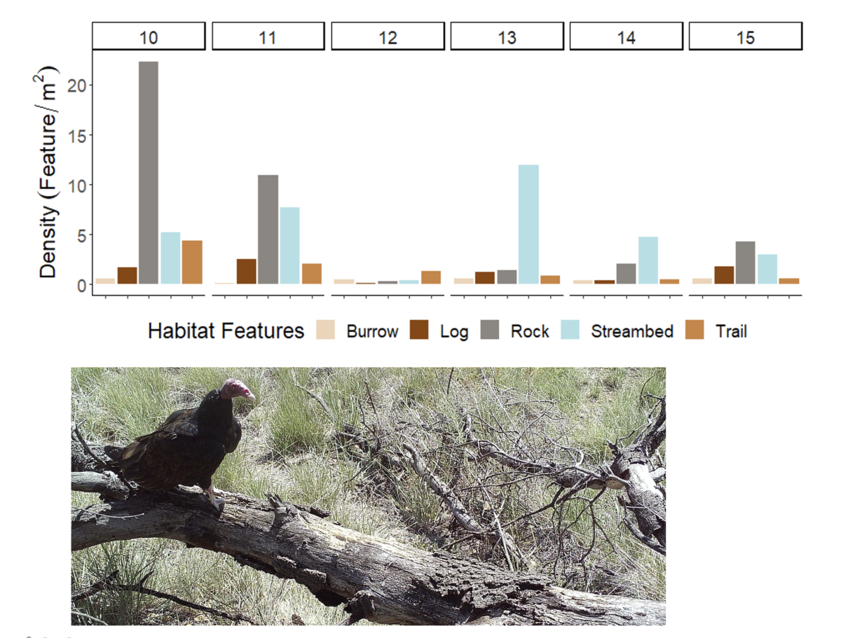 The data from these measurements reveal the subtle differences in dominant vegetation across the study and even show that the most grassland-dominated habitat in the San Rafael Valley (block 12) has some tree canopy, mostly because the Santa Cruz River is lined with cottonwoods.
Watch our webinar report on the first year of the Border Wildlife Study.
The next step in our analysis is to look at species we found associated with vegetation and habitat features to see how much the habitat characteristics explain where we’re most likely to detect each wildlife species in the corridor.

We are also watching how the habitat within our study range is impacted by the region’s extreme drought. We are concerned that the lack of rain has reduced the food sources available to wildlife species, and this may explain lower detection levels of both mammals and birds in spring 2021 relative to spring 2020. We are hoping for a wet summer with monsoon rains and, if the rain does come, will watch for positive changes in the vegetation and wildlife community.
Related Reading: