What do wildland fires have to do with water?
Lots, actually! In addition to the more obvious and immediate impacts—burned vegetation and habitat destruction—wildfires have extensive hydrological and ecological effects on watersheds. These impacts include erosion, debris flow, flooding, and changes in water quality—all very important factors for ecosystem health.
In the past 15 years, 25% of the Sky Islands on the U.S. side have burned in wildfires (Monitoring Trends in Burn Severity). Here, in Southern Arizona, where wildland fire season in late spring is followed by intense summer monsoon rains, the damage to springs, streams, and entire watersheds can be especially catastrophic. Sky Island Alliance has been working to mitigate these effects and increase resilience to wildfires.
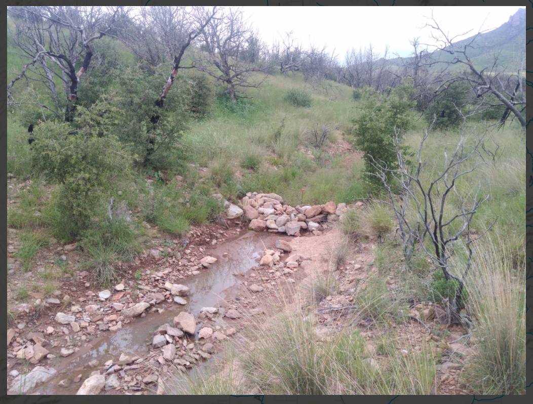
Figure 1: Loose rock structures slow water, reduce erosion, and trap sediment.
In 2015, we collaborated with stakeholders to address erosion in the Chiricahua Mountains by installing loose rock erosion control structures in drainages of two watersheds: Tex Canyon and Barboot. While Tex Canyon burned in the 2011 Horseshoe 2 Fire, Barboot was unburned but at risk for high severity fire, creating a compelling pair for long-term comparison study sites. Over 700 rock structures were built in the two watersheds to slow water, trap sediment, and ultimately reduce potential erosion. Stations were also installed to measure soil moisture and water retention at the sites for continued monitoring.
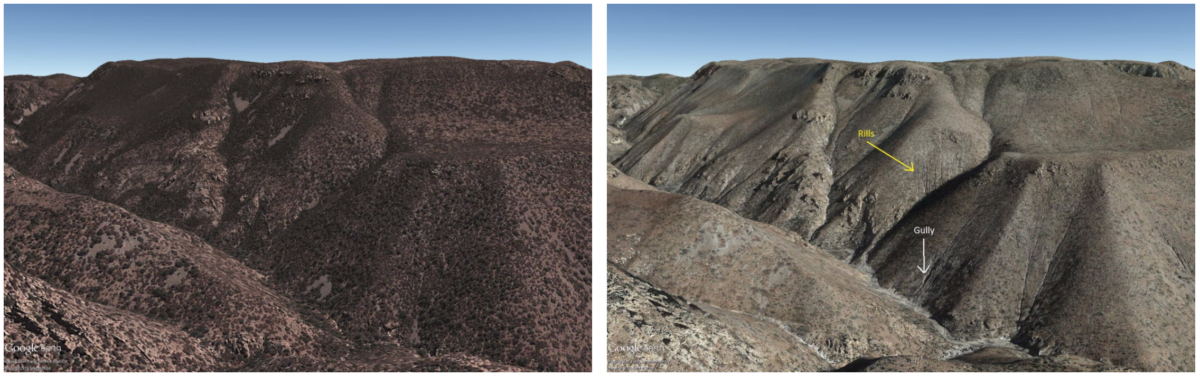
Figure 2: Shake Gulch, a tributary of Tex Canyon, before (left) and after (right) the Horseshoe 2 fire. Notice the rills and gullies that developed after the fire.
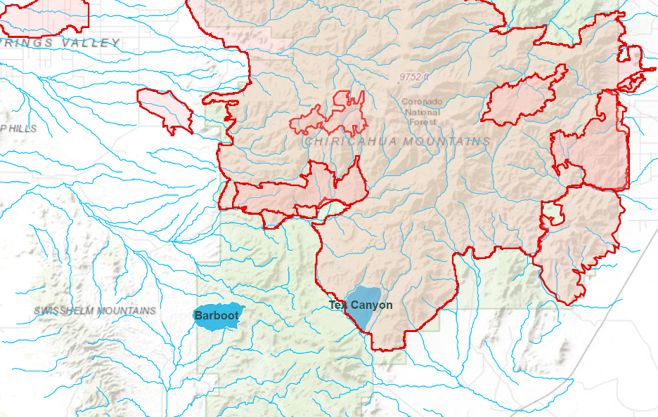
Figure 3: Barboot and Tex Canyon Watersheds, along the Southern border of the Chiricahua Mountains. Loose rock structures were constructed in the burned Tex Canyon watershed and the unburned Barboot watershed.
The watershed restoration and infrastructure completed in 2015 continues to be an integral component in strengthening ecosystem resilience to climate change. And, we’ve already seen the rock control structures in action! The structures have backfilled with sediment, which is crucial in keeping the water on the landscape longer. The structures are acting like a sponge— slowing the water flow, encouraging pools of water to collect, and serving as habitat for wildlife like the tadpoles seen in Tex Canyon.