“The drainage that comes out of a rock, a crack in the rock, does not give you the option to look for the largest source of water, or for a larger current […] the water flows as if it were coming from a fountain, very slowly”.
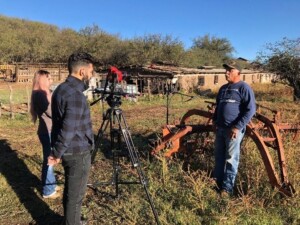
One of the interviews at Rancho el Ojo de Agua in Cananea, Sonora.
This is a fragment from a conversation with one of the ranchers in Sonora that we interviewed last year to better understand the challenges of water resource management in the Sonoran Sky Islands. He was talking about the difficulties of finding water and of managing springs in the correct way. As in the Sky Islands of Arizona, the big problem for ranchers, wildlife and ecosystems, is the increasing water scarcity in the region of which, not surprisingly, climate change and groundwater extraction for mining and large-scale agriculture are the usual culprits. For the Sky Islands to thrive, and for them to help our communities thrive, they need to keep their water sources plentiful and healthy. To protect Sky Island waters at the regional scale, we need to identify and map as many of the remaining natural springs in the region as possible, and work to protect them and restore them wherever necessary. This is why we have been expanding our Water Program into the Sky Islands of Sonora, Mexico.
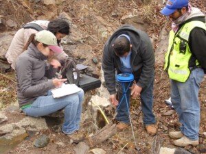
Spring assessment conducted by Sky Island Alliance staff and volunteers from the University of Sonora.
Starting in 2017, we partnered with the Springs Stewardship Institute, Saguaro National Park in Arizona, and the University of Sonora in Mexico. Together, we hosted two major workshops in Sonora on methods to conduct springs assessments, after which we were able to detect and survey 25 springs located in the Sierra la Madera (15 springs) and in the Sierra el Tigre (10 springs). One of the central goals of a spring assessment is to correctly identify and classify the type of spring that you are looking at; to determine its geomorphological and hydrological characteristics. Does the spring flows out from a cave or is it gently flowing down from a hillslope? Or maybe the water is emerging from some fracture through mudstone or shale; or emerging into a stream flowing from many other springs further up the mountain. Assessing these and other traits of springs in the Sky Islands of Mexico, is giving us a good idea of the type of conservation, restoration, and land management approaches that, together with landowners and local authorities, we can take across the region.
Compared to the Sky Islands of Arizona, the Sonoran Sky Islands lack much data on springs and on the immediate ecosystems they support, and thus, we are excited that our Water Program will contribute to narrow this gap in the near future. Early this year, thanks to our Mexican partners PROFAUNA, we conducted more specific interviews with eight ranchers that allowed us to know more how their properties, their ecosystems, and their livelihoods are being affected by rapid social and environmental change, but more importantly, about how can Sky Island Alliance help them better adapt and cope to these changes.
In the coming weeks we will be sharing some of their perspectives and the work we will be doing with them for the springs of the Sky Islands in Sonora. In the meantime, you can check out some of the results about the spring types assessment in Stay tuned!
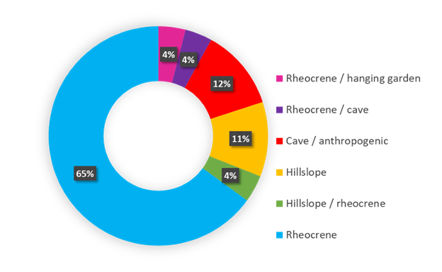
Distribution of spring types assessed in Sierra La Madera and Sierra el Tigre. Rheocrene springs are those that emerge into an already formed stream or channel that may have one o more sources further upstream. A cave spring emerges within a cave system and flows outward into the surrounding landscape. A hillslope spring happens where groundwater flows out on a relatively gentle slope and it can be a focused or diffused flow. Anthropogenic means that it has been created by human action.
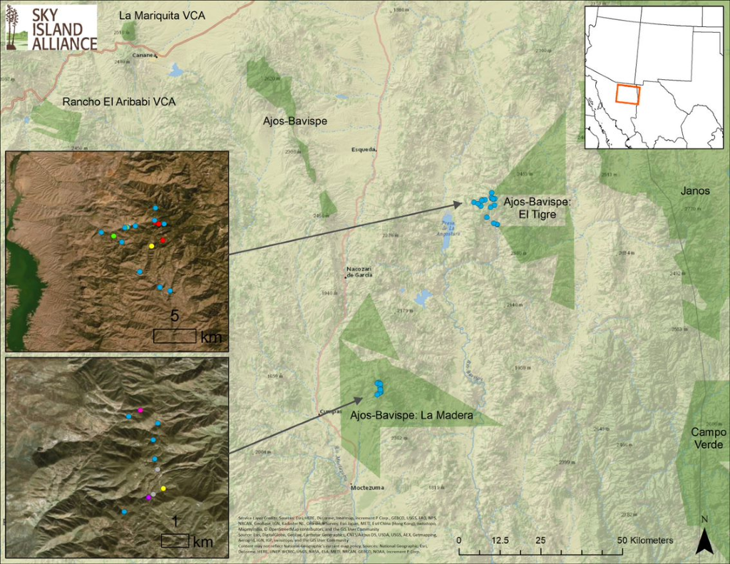
Location of the springs included in the initial assessment. The colors of the points in the left side inset reflect the type of spring based on the chart above.
About Paulo: I am the incoming Conservation Manager for Sky Island Alliance. For more than 10 years now I have been working in conservation science and management in Mexico and the U.S., including working for the National Commission of Protected Areas of Mexico (CONANP) and doing research in forest ecology, climate adaptation, and conservation planning and evaluation at the Yale School of Forestry and Environmental Studies and the University of California Santa Cruz. I am passionate about mountains, their ecology, their natural history and the social and cultural relationships humans have with them. For the most part of my career I worked in the spectacular volcanoes of central Mexico. I live in Tucson now and I am eager to get to know every single Sky Island in the region and work hard to understand them and protect them.